Showing posts with label Travel. Show all posts

Monday, September 17, 2018

Bruffey Memorial United Methodist Church

Back in May, when we were tooling around the borders of Virginia and West Virginia, we took a side trip over to Gap Mills, West Virginia.

The land there is lovely. From Sweet Springs to Gap Mills, there is a long valley full of gorgeous farmland.

We were searching for a church called the Bruffey Church. That was all I knew about it at the time. Allegedly some of my relatives started this church.

We could not get inside the building, and while we ran into one person there, that person offered no information about the structure or its history.

It's a plain little country church

You see structures like these all over southwestern Virginia and West Virginia.

My husband wondered why the cross was lopsided on the front.
The full name of the church is the Bruffey Memorial United Methodist Church. I don't know if it has always been Methodist.

As best I can tell from an unproductive internet search, about 30 people attend services here. There was no cemetery attached to the church so I am not sure where relatives who attended this structure might be buried.

There is a Facebook page for the church and I've written to see if there is a history available. I'll update if so.

Monday, July 25, 2016

Our Great Outing

With temperatures roaming around near 100 degrees over the last several days, the air is tough to breathe and working outside near impossible.

So Saturday my husband took a rare day off from working on the farm. We took a drive.


This is us, getting ready to head out. My husband has a dip
of chewing tobacco in his mouth. Sigh.
 

This used to the Roanoke County Courthouse, but it is
now part of Roanoke College.
 

We ate lunch at Macados in Salem. They have good
chicken salad. While we were there, we watched a parade
of vehicles with confederate flags and other decorations
go by.
 

This is downtown Salem, or what's left of it. I remember it
differently than what it looks like now.
 

This is the ponds in Salem. I caught a big catfish in there
once during a fishing rodeo.
 

No trip is complete without a stop at Walmart for something.
 

Heading into Elliston, the Blue Jay Motel greets travelers.
I always take a picture of it because my great Aunt Ruth and
Uncle Ted once managed the place. Best blueberry pancakes ever.
 

Christiansburg means cars. We checked on the new Camrys.
Not impressed enough to trade in my 2014.
 

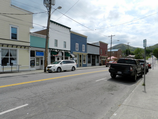
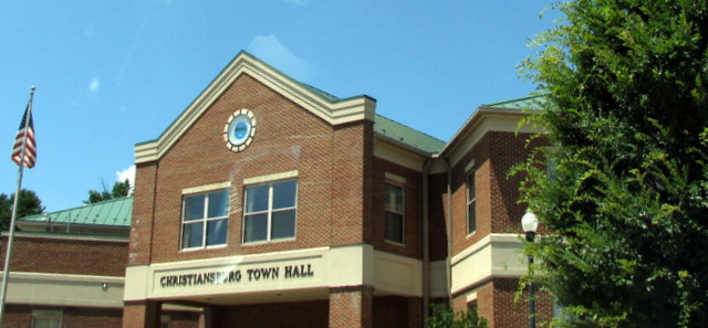
We drove through Christiansburg downtown.
 

We came across a car show.
 

We did not get out because it was really hot.
 

We went into this store to see if they had any chair
end tables. They did not have what we wanted.
 

This is what we went to look at it. Yes, junk.
 

Farm junk. Pieces of stuff that mean nothing to me.
 

The stuff does, however, mean something to my husband. But
he did not find what he wanted on this day.

And that was that. I slept most of the way home. I don't do well on long adventures anymore. We were out about five hours, I suppose.

Our great outing.

Saturday, August 13, 2011

Wild Wonderful West Virginia Part VI

Part VI - Sandstone Falls

Sandstone Falls are the largest falls on the New River. They span 1,500 feet.


The National Park Service offers the Sandstone Visitor Center just off Interstate 64. About five miles from there, one can see the falls from a mountain overlook that is 400 feet above the falls.


A boardwalk allows you to access the falls. However, we did not go down there. To reach the boardwalk required another 30 minutes of driving, following the river south and then across at Hinton, WV, and then back north. We elected not to take that drive this time.


Even from a distance, the falls were very impressive.

Here is a site with more information and much better photos: Click Here.

The National Park Service has photos, too: Click Here.

That pretty much covers our trip! Thanks for reading about Wild, Wonderful West Virginia as seen through touristy eyes.

Friday, August 12, 2011

Wild Wonderful West Virginia Part V

Part V - The West Virginia Music Hall of Fame

The West Virginia Music Hall of Fame is located inside Tamarack. We didn't even know West Virginia had a music hall of fame. The exhibit at Tamarack is permanent, but according to the website, they also have a traveling museum!


As you might expect, many of the records reflected country, bluegrass, and Appalachian folk music.


An impressive number of musicians hail from West Virginia.  They have a virtual hall of fame of their inductees at this link. However, I confess, that, aside from Kathy Mattea and Bill Withers, I haven't heard of very many of them. However, I don't listen to much country or bluegrass so of course I would be ignorant of the contribution of these folks.


That guitar is a Martin, played by Bill Withers. He is a successful singer-songwriter. His songs include Ain't No Sunshine When She's Gone, and Lean On Me. Those songs were successful in the 1970s.

We enjoyed this exhibit as much as we did the display of arts and crafts at Tamarack.

Next: Part VI - Sandstone Falls

Wednesday, August 10, 2011

Wild Wonderful West Virginia Part IV

Part IV - Tamarack


Tamarack, in Beckley, WV, is a cultural center/showcase of art. The art has been carefully chosen (juried) and so is some of the best around. It's named after the Tamarack tree, which is a kind of conifer tree. It is unusual in that it loses its leaves or needles.


The structure is supposed to look like a quilt from the air.


Inside we saw 59,000 square feet of lovely things. I was greatly impressed by an $18,000 coffee table, though a $270 rocking chair, made with a mix of dark and light colored wood, was more in my price range. They had some really nice items and it is a shame that we brought nothing home.

The work of many jewelry makers, photographers, painters, and woodworkers was on display. The Greenbrier has a shop there, and there is a nice place to have a meal, too. It is cafeteria-style.

This would be a great place to go Christmas shopping. I suggest taking the girls and leaving the husbands behind, though!

Next: Part V - The West Virginia Music Hall of Fame

Tuesday, August 09, 2011

Wild Wonderful West Virginia Part III

Part III - The New River Gorge Bridge
The New River Gorge Bridge is on US 19. It crosses The New River and spans the huge gorge carved out by those ancient waters. The arch bridge is 3,030 feet across, and is the third largest of such structures in the world.

Before the bridge was built, it took 45 minutes to get around the New River gorge. Now it takes about 49 seconds to drive across it.

About 16,500 vehicles go over the bridge every day.


The structure cost $37 million to build. It was constructed in the 1970s.


The bridge is 876 feet above The New River.


The National Park Service has a series of decks which one might venture down to see the river and the bridge. However, it was over 20 floors or levels (more than 200 steps) and neither the husband nor I cared to make the climb back up. We both have bad knees.


The arch that creates the base of the structure is quite incredible. Photos in the museum in the visitor's center showed men walking along these steel beams like they were out for an evening's stroll.


This bridge will count as one of the most amazing feats of man-made genius I have ever seen. This was produced during a time of greater vision, when we had real statesmen and visionaries in office.


I could have looked at the bridge all day.


Go see it!

Click here for a google images link to amazing photos of this bridge.


Next: Part IV - Tamarack

Monday, August 08, 2011

Wild Wonderful West Virginia Part II

Part II - The New River

We arrived at our destination around 11 a.m. The day was overcast and foggy, which did not make for the best photo opportunities.


The Canyon Rim Visitor's Center. Inside there was a museum detailing the life of miners and Appalachian folk. They also offered a 10-minute film on the river and the local area.


The New River flows north - which most rivers on the east coast do not do.


The gorge was relatively inaccessible until 1873, when the railroad came in along the river. This allowed for shipments of coal. Mining towns grew up near the coalfields. There were many clashes between miners and coal company bosses. You can read about The Battle of Blair Mountain, which was one such fight, at the link.


The New River Gorge is the east coast's version of the Grand Canyon. The river is a tiny ribbon winding its way through a forested carpet. The river has rapids and is frequented by kayakers and fishermen. The ecosystem also houses many rare plants. Congress established three parks in 1978 in order to preserve and protect the watershed. The parks encompass 53 miles of the river and 40 miles of tributaries. The parks are called the New River Gorge National River, Gauley River National Recreation Area, and Bluestone National Scenic River areas.

The New River is actually the oldest river in North America. The river has been heading north for 65 million years. The New River was once part of a longer river called the Teays, but about 10,000 years ago, glacial ice buried much of the river and changed its course.

The New River was in place before the Appalachian Mountains were formed. Scientists can tell this because it flows across the Appalachian Plateau, not around it. The river begins in North Carolina, then flows north into Virginia. It passes through Radford and eventually winds its way north to West Virginia. The river later merges with the Gauley River to form the Kanawha River.

The link here on Wikepedia has some good photos if you're interested.

Next: Part III - The New River Gorge Bridge

Sunday, August 07, 2011

Wild Wonderful West Virginia Part 1

Part 1: The Journey Out

Yesterday we took a day and headed north and west to West Virginia. Our destination was Fayetteville, specifically the Canyon Rim Visitor Center on Highway 19. We wanted to visit the New River Gorge. This is a 70,000 acre park along the New River between the towns of Hinton and Fayetteville. The park is part of the National Park Service.

The two-and-a-half hour drive took us through Iron Gate. This is a small town that sits on the borders of Alleghany and Botetourt counties.


Blink and you will miss it.


I wish I had a better picture. Outside of Iron Gate, not far from Clifton Forge (which you no longer drive through but bypass on I-64), a U.S. flag sits high on an outcropping of rock called Devil's Backbone. Someone has been placing a flag there for as long as I can remember. My father has family in Summersville, WV. We used to visit when I was a child and I would always look for the flag in the rock. You can read a story about the flag here.


Heading into the mountains.


We took a detour off of I-64 to pass through White Sulphur Springs. Hubby wanted to visit an ATV dealer while we were in the area.


White Sulphur Springs is like most of small town America today - older, not as vibrant as it once was, beaten down by Walmart. Yet it still had some folks moving around. I thought it had a little more movement than some small towns I have traveled through.


Before I knew it, we were at the entrance to The Greenbrier. I barely got the camera up in time to snap some sort of photo. The Greenbrier is a place for the very wealthy. However, they offer a few things, such as the bunker tours and casino gambling, that might be of interest to us peons. I could never afford a room there, though. At $285 per night for a single bedroom, I think I'll just drive on home.


You can't see much of The Greenbrier because it's all fenced off. That was rather disappointing. Anyway, we weren't stopping there today so we simply drove past.

Next up: Part II - The New River